


A map provides overhead views to help hunters
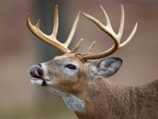
It may be July, but it is never too early to prepare for the opening of deer season. From developing a cool-season food-plot plan and hanging tree stands to studying the landscape and travel corridors, diehard whitetail enthusiasts can make the best of their summer preparing for their upcoming season.
For one reason or another, many hunters wait until the last minute to start working on their hunting properties. Actually, they can perform hundreds of things right now that need to be done. And dull moments are few and far between. Hunters should reflect on previous seasons and identify key features on your land. This will increase the odds of being in the right place at the right time. When hunters see these high-traffic areas on paper, it can be an eye-opening experience.
Hunters can benefit from a better knowledge and understanding of the terrain and animal travel patterns. Most hunters have a long history on a property. So they already have a feeling about deer movements from opening day to Jan. 1. They’ve gained this knowledge from years of scouting, hunting different stands and sifting through thousands of trail-camera images. But many are always looking for a better place to hang a stand to see that big buck in legal shooting hours.
All hunters can benefit from this preseason work
It doesn’t end at still- or stand-hunters, either. Hunters with a kennel of hounds have a keen advantage in understanding deer travel routes and bedding areas. Hunters with a long history on a property know where deer will generally bed. They also know where deer will get up and go, and where they will cross interior roads when pushed. As soon as the hounds jump, the elders predict exactly where a deer is going to cross. They are usually correct.
Additionally, today’s deer hounds are usually carrying GPS tracking collars. So hunters can watch on handheld screens and see where the dogs are with precision. When they are hot on a big buck, the paths they choose are normally the habitual routes they can plot on a computer screen.
For most productive hunters, success comes from years of info gathered by trial and error and stored in their brains. Most people learn better visually. So to gain the greatest advantage over their prey, hunters should use aerial photographs and transcribe their knowledge of deer activity onto paper or electronically onto computer-mapping programs.
A map is a big help
Hunters using hounds can benefit greatly by using maps loaded with historical data on deer crossings and bedding areas. Not only will a map assist hunters to figure out where to put standers on a hunt, the hunt organizer can determine the size of the areas to hunt with the number of hunters they have. They should mark potential stand locations on these maps to see how many hunters are needed to cover a hunting area.
Hunting properties are broken up into terrain components, including fields, swamps, streams, thickets and a range of different forest types of various age classes. Hunters should identify all deer stands, major crossings, bedding, feeding, travel corridors and anything else that seems important. Seeing these areas on paper will help hunters make decisions on where to set up new stands or where and when to hunt stands at different times of the season or on different wind directions.
Make plenty of notes and revise maps routinely when new information is gathered throughout the season. Make sure to include notes on positive and negative outcomes on various stands. Sometimes, negative feedback on a stand location or former stand location is the best information and should never be omitted. The more information added to these maps, the better-equipped hunters are to make the best decisions and spend the best hours in the woods in the most-opportune areas for the best chance at encountering a big trophy buck.
Information is the key to happiness!


Be the first to comment