Graham County stream has plenty to offer
Many veteran trout fishers consider Big Snowbird Creek in Graham County as one of the best streams in the far western section of North Carolina. And since July 2013, it’s had four distinct fisheries. That’s when the NCWRC re-designated a 2.8-mile section of hatchery-supported waters as delayed-harvest waters.
The delayed-harvest section starts at a foot bridge just above the Junction at the end of Big Snowbird Creek Road. And it continues to a concrete bridge known locally as Chestnut Flat Bridge. From that bridge to another bridge on SR 1275, approximately nine miles, the stream remains hatchery-supported waters — stocked from March through August with tens of thousands of trout. This section is heavily fished during the stocking season. By the first of September, the stream is fished out, mostly by locals who keep close tabs on stocking schedules.
A gravel road (FS 2579) runs parallel to the delayed-harvest waters, providing easy access to the stream. The U.S. Forest Service maintains seven creekside campsites along Big Snowbird Creek Road below the Junction. The sites are well-shaded, some with picnic tables and fire rings.
Some modern conveniences make the trip less rough
The Forest Service replaced the old portable toilets with a chemical pit toilet, located about halfway between the seven camping sites. The camping sites are considered “primitive,” and no fees apply. Primitive camping also is permitted anywhere in the upper section, except within 50 feet of the stream.
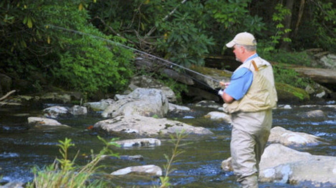
From the Junction parking lot, where Big Snowbird Creek Road ends, to Lower Falls (also known as Big Falls), the stream is wild-trout waters. Anglers can only access it by foot. This section contains good populations of rainbow and brown trout. The rainbows outnumber browns about 10-to-1. With a high tree canopy and wide streambed, this 5‑mile section offers excellent fly fishing conditions.
Numerous mid‑sized rocks make hopping from run to run fairly easy. Huge boulders provide good cover for casting into the numerous deep pools, runs, and pocket water. Rhododendron overhangs provide ideal hiding places for trout. And if you can skip a dry fly under those low branches, you’re almost certain to entice a strike. The gradient is moderate, and the stream is shallow enough to wade — with a few exceptions. Because of the dense forest canopy, much of the creek is shaded, and wading can be hazardous in places because of mossy‑slick rocks.
The fishing is good all around
For continuous fishing, it’s best to stay in the creek from the Junction up. Although the trail follows the stream, it often runs high above the water, providing limited access unless you’re willing, and able, to climb down steep, overgrown banks.
Brook trout country begins at Lower Falls. And from there to the stream’s headwaters, a distance of about seven miles, lies some of the best brook trout fishing in the state. From Lower Falls to Middle Falls to Upper Falls, the stream is fed by numerous tributaries, most of them also populated by brook trout.
For the best fishing experience, backpack to Mouse Knob. It’s an old logging camp site just below Lower Falls. Set up camp, and spend a couple of days fishing the brook trout waters.
Native brook trout
The average brook runs six to seven inches. But some of the deep pools, especially around the waterfalls, produce an occasional 12‑ to 13‑inch brookie, which is large for the Southern Appalachians. Samplings taken from the brook trout portion of Snowbird indicate that these trout have a “high probability” of being true native Southern Appalachian brookies, according to N.C. Wildlife Resources Commission biologists.
Mayflies make up the primary food source in the upper section of Snowbird. Caddis flies are next, with midges running a distant third. Mayflies also are the dominant food source in the middle section, with caddis flies and midges about evenly divided. The hatchery‑supported section has small mayfly and caddis fly hatches.
Destination information
Getting there: From the junction of US 129 and SR 1127 (Joyce Kilmer Road) in Robbinsville, go 3.3 miles to the junction with SR 1116 (Massey Branch Road) and turn left. Bear left at the fork on SR 1127 and go to the junction with SR 1115 (Little Snowbird Creek Road). Turn left and go 2.2 miles to the junction of SR 1121 (Hard Slate Road) and take a sharp left. Continue one mile to a bridge over Little Snowbird Creek. Go right on SR 1120 (Big Snowbird Creek Road) and go six miles to the Junction parking area. From Robbinsville, the distance is about 14 miles.
For additional information about Big Snowbird Creek, contact the U.S. Forest Service, Cheoah District, Route 1, Box 16A, Robbinsville, NC 28771, 828-479‑6431.


Be the first to comment