Hunting North Carolina’s Game Lands or any other unfamiliar parcel of land should always start with a map of the area before to investing too much time on site.
Maps will identify access, property boundaries, habitat types, water resources and even potential stand locations. Maps can be aerial photos, topo maps, or just a road map that includes the tract.
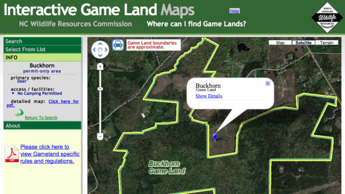
Hunters can get maps from local Natural Resources Conservation Service offices or from the N.C. Wildlife Resources Commission, but the internet is the best source for obtaining remote imagery. Google Earth is probably the most widespread mapping service used by the public, but, the N.C. Wildlife Resources Commission’s Interactive Mapping Service website (found at www.ncwildlife.org) catalogs all Game Lands in an easy-to-use software program. Parcels can be navigated using an aerial photo, terrain or standard road-map background. It also identifies property boundaries, water features, land topography, safety zones, restricted areas, and other data layers useful to hunters.


Be the first to comment