
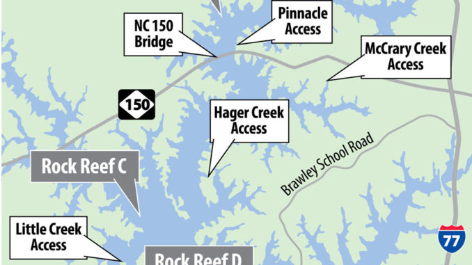
Numerous websites, including one belonging to the N.C. Wildlife Federation, provide map coordinates, not GPS coordinates, for the Lake Norman artificial rock reefs. Fortunately, there are readily available tables to convert map coordinates to GPS coordinates.
Jake Bussolini, co-author with Mac Byrum of “The Catfish Hunters,” explained the conversion.
“Take a map coordinate such as 36 degrees, 30 minutes. Divide the 3630 by 60, giving you .6005. This becomes the correct set of figures for the end of the GPS coordinate, making it 36.30.6005.
For Lake Norman’s rock reefs, Bussolini provided this table.
Map GPS
Coordinates Coordinates
A. Latitude 35⁰39’9.30” 35⁰39’.1616”
Longitude 80⁰57’18.31” 80⁰57’.305”
B. Latitude 35⁰36’52.38” 35⁰36’.873”
Longitude 80⁰56’35.82” 80⁰56’.597
C. Latitude 35⁰33’2.52 35⁰33’.042
Longitude 80⁰58’18.12 80⁰58’.302
D. Latitude 5⁰31’50.10 35⁰31’.835
Longitude 80⁰56’19.56 80⁰57’.326
E. Latitude 35⁰55’20.15 35⁰30’.6005
Longitude 80⁰56’19.56 80⁰57’.326
F. Latitude 35⁰30’5.52 35⁰30’.092
Longitude 80⁰56’42.36 80⁰56’.706
Be the first to comment