


We sometimes take state-of-the-art electronics for granted
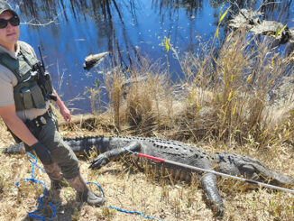
Search and recovery divers were pretty much on their own back in the early 1980’s; I know because I was one of them. I spent 10 years on the Dallas Fire Department’s dive team and worked from the department’s drag boats before the dive team came to be. Fireman Thad Moore, owner of a SCUBA shop in Dallas, thought we could do better for the families of drowning victims than recovering them with drag hooks. He developed a search and recovery class for SCUBA divers, canvassed the department for volunteers and the Dallas Fire Department’s SCUBA Search & Rescue team was born.
Divers commonly face two problems: It is extremely difficult to get good information from witnesses about where to start a search, and a large part of the diving is done in water with zero visibility. Our high-tech approach consisted of dropping bleach jug floats anchored by small chunks of concrete in a pattern ensuring that their search areas overlapped slightly. Two divers, one with 30 feet of clothesline looped over one arm, followed a buoy’s line to the bottom. The diver with the rope seated himself next to the concrete anchor and the other diver slipped a small loop tied on the end of the rope over his arm and started swimming in an expanding circle around the anchor point. Each time the swimming diver passed in front of him the seated diver let out another arm’s length of rope. When all the rope was extended the two surfaced and went to the next buoy and started over.
It took a lot of manpower and sometimes several days to locate a victim. A better way was needed and my very good friend and mentor, Thayne Smith, came up with one. Smith, then director of public relations for Lowrance Electronics, wrote a book entitled “In a Time of Need” that became a handbook for search and recovery teams across the U.S. and Canada. He explained the concept of searching with sonar using his company’s paper chart recording sonar graph. The book detailed how to set up and run search patterns with a sonar-equipped boat and included reproductions of chart pictures to help crews identify everything from illegal fishing nets to sunken boats and drowning victims. His methods sometimes reduced search times from days to hours. Team members now only had to lay out a pattern of buoys and run straight-line search legs between them. Dive times were greatly reduced because only suspicious chart readings were investigated by divers.
Off duty, I was a part-time fishing guide and outdoor writer/photographer completely familiar with Lowrance’s paper chart recorders. Lowrance eventually hired me away from the DFD to go on the road teaching Smith’s search principles at law enforcement and search and recovery seminars around the country.
Advances in marine electronics have greatly improved sonar’s effectiveness for search and recovery teams. Multifunction displays can now integrate GPS with sonar and record hours of scrolling sonar imagery. These sonar records can be played back on the units’ screens or on portable computers and likely targets can be marked as geo-tagged waypoints to be investigated by divers. The development of photo-like side and down-scanning imagery has further reduced search time by increasing the area a single pass of a boat can scan.
Fast-forward to today’s headlines and we find cutting-edge marine electronics helping large-scale, multi-national search and recovery operations like the hunt for the lost Malaysian airliner MH370. One type of electronics being used can also help fishermen and recreational boaters. Virtually every boater who shares the water with maritime cargo ships worries about being run over by one of the giants because nobody onboard saw him. In fog or darkness we all worry about smaller craft not seeing us, too. The Automatic Identification System (AIS) was conceived to help prevent such collisions by putting an icon representing your boat on the radar and navigational chart screens of every AIS-equipped vessel around you. And, of course, all AIS-equipped vessels also appear on your screens. You can “see” them and they can see you and the click of a button on an icon can bring up its vessel’s name, course, speed, classification, call sign, registration number and other information depending upon the class of AIS system you have onboard.
As of January 1, 2005, nearly every commercial ship over 65 feet in length in U.S. waters has been required to be AIS-equipped. Ships mandated to have AIS usually require a class A system while smaller boats not mandated (like us) can use a simpler and less expensive class B system. Class B systems include the critical safety features of class A but don’t deal with as many information fields and don’t transmit information quite as often.
An AIS transponder mounted on a boat or ship transmits and receives information automatically over two digital VHF radio channels. This limits the system’s operational range to that of a VHF radio, usually about 25 miles over open water. Transponders can show AIS information on dedicated displays and on multifunction navigational chart and radar displays that are AIS-compatible. You can also acquire just an AIS receiver but they don’t add as much safety because they only receive. They show you where everyone else is but they don’t show others where you are. If your chosen transponder or receiver is WiFi-enabled you can probably display its information on a smart phone, tablet or computer. A dedicated AIS antenna can be used to send and receive signals or you can install an AIS/VHF splitter on your existing VHF radio antenna.
Vesper Marine (vespermarine.com), a New Zealand manufacturer of marine safety products and virtual aids to navigation, recently announced that its Virtual AIS beacons are employed in the search for the lost Malaysian airliner in the southern Indian Ocean. After an exhaustive period of ocean floor mapping the search is focused on an area roughly twice the size of Massachusetts. Salvage vessels are towing deep-water, side-scan sonar arrays approximately four miles deep and 300-500 feet above the sea floor. It takes about six miles of tow cable to reach those depths and the Virtual AIS beacons aboard each of the search vessels virtually mark the positions of the tow cables and sonar arrays to prevent collisions. Amazingly, the latest generation of AIS equipment can even project protection to search equipment that may not otherwise be detected in time to avoid colliding with it. I can’t wait to see what manufacturers are going to surprise us with next!
Underwater search and recovery is a difficult, under-appreciated and sometimes a dangerous undertaking that can mean the world to the friends and families waiting on shore. My hat is off to anyone willing to do it!


Be the first to comment