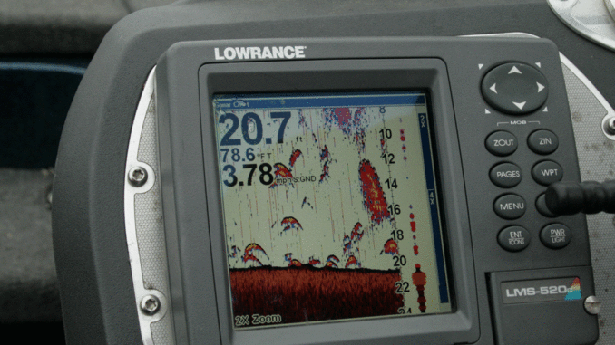
Dearal Rosgers is a big believer in studying the underwater topography for summertime success. He uses a wide screen, sides-scanning Hummingbird graph with GPS mapping of Lake Wateree for starters, as well as a Lowrance graph.
“Electronics are tools that provide a road map to success,” he said. “The key is finding a variety of offshore targets, and I rely on this equipment at this time of the year just as I do a good rod, reel and lure. It is a key to summertime success. While you can find these areas with a flasher unit or simple graph, I try to utilize all the modern technology I can so I use my GPS and graphs to the max to pinpoint targets.”
Rodgers said some good maps are available that depict the underwater contours of Wateree, and they are well worth the investment, even if an angler has the Sonar/GPS combo.
“Through the years and due to the age of this lake, siltation has changed some of what you will see on these maps,” he said. “However, they are generally good guides to potential areas. Plus, I recommend keeping one eye on the depth finder when moving from one spot to the next. A couple of my favorite July hot spots were not found on maps, but on real-time graphing the bottom.”
Rosgers said maps are particularly useful to pinpoint the flooded roadbeds that wind across flats and the creek-channel bends that offer big-fish opportunities. He said bass use these roadbeds and the remains of old bridges as travel corridors just as people did before the lake was impounded.

Be the first to comment