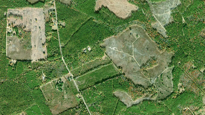
Many sportsmen utilize navigation apps on their smartphones. OnX, Gaia and a number of similar apps provide useful information to outdoorsmen. But physical maps still have their place.
MyTopo maps, whether rolled out on the trail, or mounted on the wall of your hunt club, provide much more than just a blue dot on a two-inch screen.
“It’s not that MyTopo maps are better than navigation apps. The two go hand-in-hand. It’s great to have the assurance of the blue dot showing you where you are, but it’s also great to plot that point on your paper map and make well-informed decisions as you traverse through the back country,” said Paige Darden, a representative for MyTopo.
And when planning out a day’s adventure with your hunting buddies, it’s much easier to do so while looking at a large map, as opposed to collectively looking at a smartphone screen.
“Big wall maps are very useful for people who want to mark out deerstands, trails, entrances, and exits,” Darden said.
They are also great for getting a feel for the overall makeup of your property, and getting familiar with boundaries. And it’s just as good for being able to see the layout of properties around yours, which can be invaluable in estimating what will attract deer and other game animals to enter or exit your property at certain locations.
Go back in time
It’s not uncommon to find old artifacts or signs of long-lost dwellings on hunting properties, and we’ve all wondered what the property was like before we ever hunted it. MyTopo allows you to see it through one of their newest collections, historical maps.
“The historical maps are popular with history buffs and geneologists, but we also find that ranchers, hunters and land owners like to see what their land looked like 100 years ago,” said Darden.
USGS quad maps are also available from MyTopo. These maps allow customers to see a map of their property, as well as that of those around them. Aside from just seeing the general layout of other areas, it can help sportsmen find suitable land to lease or purchase without having boots on the ground. It can also help anglers find private ponds near them, which can lead to more fishing spots once the pond owners are contacted.
Get a map of your hunting spot at mytopo.com


Be the first to comment